Natural Landscapes in Syria: Syria is often recognized for its archaeological and historical depth, yet its natural landscapes remain an equally important part of the country’s identity. Beyond ancient cities and ruins, Syria offers a diverse geographic environment shaped by mountains, rivers, forests, coastlines, and desert systems.
Nature in Syria is not defined by isolated locations but by interconnected landscapes influenced by climate, elevation, and geological structure. From the green coastal mountains to inland river valleys and open desert regions, each natural system contributes to a broader environmental framework.
This guide is designed for travelers and researchers looking to understand nature in Syria and identify the most relevant natural places to visit. Rather than listing destinations randomly, it organizes Syria’s landscapes into clear categories, allowing for efficient navigation and deeper exploration through connected resources.
Overview of Natural Landscapes in Syria
| Category | Main Regions | Landscape Type | Best Season | Visit Time | Significance |
|---|---|---|---|---|---|
| Lakes | Northern and Southern Syria | Natural and artificial water bodies | Spring and Autumn | 1 to 3 hours | Moderate to High |
| Forests | Coastal mountains | Dense vegetation zones | Spring and Summer | Half to full day | High |
| Beaches | Mediterranean coast | Sandy and rocky coastline | Summer | Half to full day | Moderate |
| Waterfalls | Western mountain regions | Seasonal cascades | Spring | 1 to 2 hours | Moderate |
| Rivers | Nationwide | Major water systems | Spring and Autumn | Variable | High |
| Caves | Limestone regions | Karst formations | Year-round | 1 to 2 hours | Moderate |
| Green Mountains | Coastal and highlands | Elevated natural landscapes | Spring and Summer | Half to full day | High |
| Natural Areas | Mixed regions | Combined environments | Variable | Flexible | High |
Lakes in Syria

Lakes in Syria range from large reservoirs to smaller natural formations, offering a different perspective on the country’s geography. These water bodies are closely tied to river systems, agricultural activity, and regional settlement patterns.
Some lakes were formed naturally, while others emerged through modern infrastructure projects. Together, they contribute to water management, irrigation, and local ecosystems.
Examples include Lake Assad, one of the largest artificial lakes in the region, and Lake Muzayrib, which reflects a more localized environmental setting.
For travelers, lakes provide quieter destinations compared to major historical sites, often requiring short visits rather than extended exploration.
Explore all lakes in Syria through the complete guide.
Forests and Woodlands
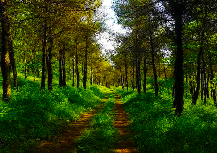
Forests in Syria are concentrated mainly in the western part of the country, where Mediterranean climate conditions support denser vegetation. These areas contrast sharply with the drier inland regions and represent the core of Syria’s green natural environments.
The coastal mountain range, including Jabal al-Ansariyah, forms the backbone of forest distribution. Locations such as Slunfeh offer examples of wooded landscapes shaped by elevation and seasonal rainfall.
Forests in Syria are not extensive in global terms, but they are regionally significant. They provide cooler climates, shaded terrain, and a different visual identity compared to the rest of the country.
For visitors interested in nature in Syria, forested areas are among the most accessible and rewarding environments.
Explore forests in Syria in the full article.
Beaches and Coastal Landscapes
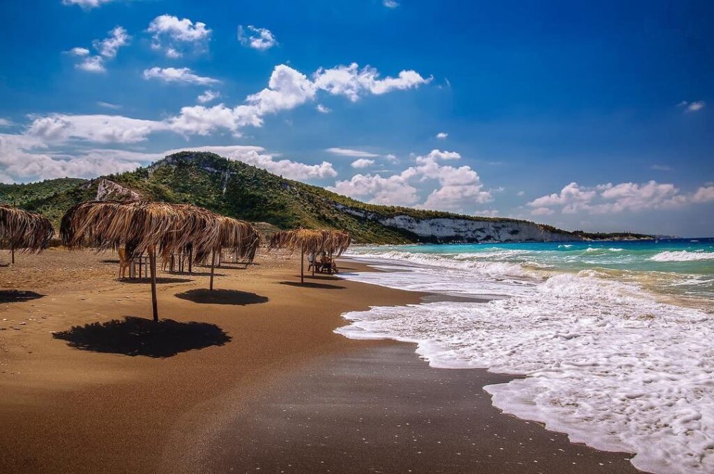
Syria’s Mediterranean coastline presents a mix of sandy beaches and rocky shorelines, forming one of the country’s most distinct natural regions. Coastal landscapes are shaped by marine influence, seasonal tourism, and proximity to mountainous terrain.
Cities such as Latakia and Tartus serve as primary access points to these coastal environments.
Beaches in Syria are most active during the summer season, when temperatures inland drive movement toward the coast. Outside of peak season, coastal areas offer quieter settings with mild weather and less activity.
For those exploring natural places in Syria, the coastline provides a balance between accessibility and environmental diversity.
Explore beaches in Syria in the complete guide.
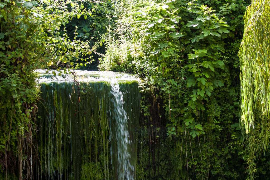
Waterfalls in Syria
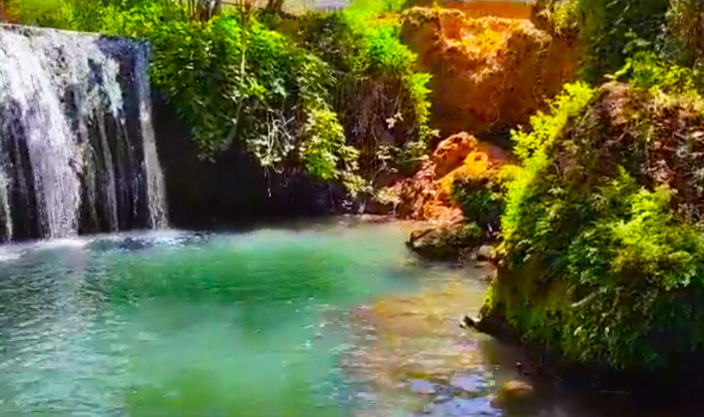
Waterfalls in Syria are seasonal features, closely linked to rainfall patterns and mountain geography. They are typically most active during spring, when water flow increases due to precipitation and snowmelt.
Unlike large permanent waterfalls found in other regions, Syrian waterfalls tend to be smaller in scale but often located within green and elevated environments.
One of the most notable areas is Wadi al-Oyoun, where multiple cascades are distributed across a compact landscape.
Waterfalls are best approached as short stops rather than primary destinations, often combined with nearby forests or mountain visits.
View all waterfalls in Syria in the full guide.
Rivers and Valleys
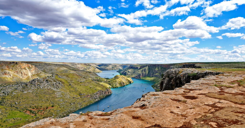
Rivers are among the most important natural features in Syria, shaping both the physical landscape and human settlement patterns over thousands of years.
The Orontes River flows through western regions, supporting agriculture and urban development along its path. In contrast, the Euphrates River dominates the eastern part of the country, forming one of the most significant water systems in the region.
River valleys often represent the most fertile and densely populated areas, making them essential for understanding both natural and cultural geography.
For travelers planning to visit Syria, rivers provide context rather than isolated attractions, helping explain why cities and settlements developed in specific locations.
Discover rivers in Syria in the complete guide.
Caves and Karst Formations
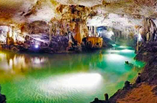
Caves in Syria are primarily found in limestone regions, where geological processes have created underground formations over long periods of time. These karst landscapes include both small caves and more extensive systems.
An example is Al-Dawayat Cave, which represents typical cave structures formed through natural erosion.
Caves are less prominent in travel itineraries but remain important from a geological and exploratory perspective. They add depth to the understanding of Syria’s natural environment beyond surface landscapes.
Explore caves in Syria in the full article.
Green Mountains and Highlands
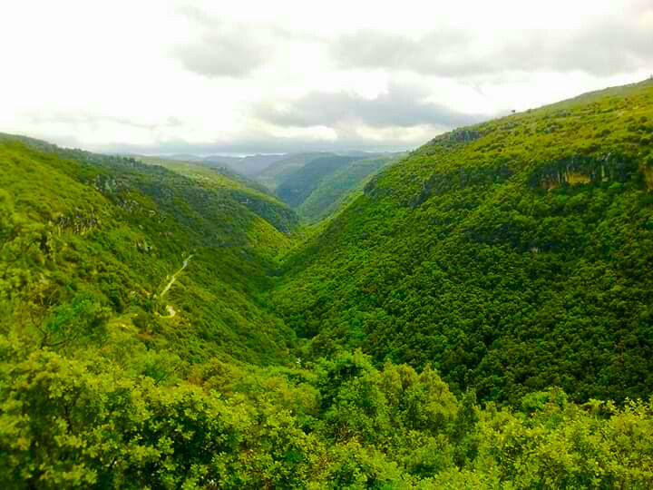
Green mountainous areas in Syria are largely concentrated in elevated western regions, where altitude and climate combine to produce cooler temperatures and seasonal vegetation.
Locations such as Kassab demonstrate how elevation influences both landscape and climate, creating environments that differ significantly from inland plains and desert regions.
These highland areas are often used as summer retreats due to their milder weather. They also provide viewpoints, varied terrain, and opportunities to experience a different side of Syria’s geography.
Explore green mountains in Syria in the full guide.
Natural Places to Visit in Syria
Some destinations in Syria combine multiple natural elements, such as water, elevation, and vegetation, into single locations. These areas are particularly useful for visitors seeking a broader experience without focusing on one specific type of landscape.
Such places often include valleys, mixed terrain regions where different environmental features intersect.
For general travel planning, these combined landscapes provide efficient options, allowing visitors to experience multiple aspects of nature in Syria within a limited timeframe.
Explore natural places to visit in Syria in the complete guide.
Understanding Syria’s Natural Geography
Syria’s natural geography follows a clear west-to-east pattern shaped by climate and elevation.
Western regions receive higher levels of rainfall due to their proximity to the Mediterranean Sea. This supports forests, rivers, and greener landscapes. Moving inland, the environment transitions into semi-arid steppe, where vegetation becomes more limited.
Further east, desert conditions dominate, with open terrain and significantly lower rainfall.
Mountain ranges play a critical role in this system by capturing moisture and influencing local climates. This explains why green landscapes are concentrated in specific sites rather than evenly distributed across the country.
Understanding this structure helps explain not only natural variation but also patterns of settlement, agriculture, and movement.
How to Explore Natural Landscapes in Syria
Exploring natural landscapes in Syria requires a different approach compared to visiting historical sites. Distances, terrain, and environmental variation all influence travel planning.
Coastal regions offer the highest concentration of forests, mountains, and waterfalls, making them the most efficient area for nature-focused visits.
Inland regions require more planning due to distance and lower density of natural attractions. Travel between locations can take longer than expected, especially when crossing different geographic zones.
Rather than attempting to cover the entire country, it is more effective to group destinations by region and landscape type. This allows for a more focused and realistic experience.
For those planning a trip to Syria, understanding these geographic relationships is essential for building efficient and meaningful itineraries.
Conclusion
Syria’s natural landscapes form a connected system shaped by geography, climate, and elevation. From coastal forests and mountains to inland rivers and seasonal waterfalls, these environments provide an essential dimension beyond the country’s historical identity.
This guide serves as a central reference point, linking together different types of natural environments while directing readers toward more detailed resources.
For travelers and researchers alike, understanding nature in Syria is not only about identifying locations, but about recognizing how these landscapes interact as part of a larger geographic system.
Ref. Global Encyclopedia: Wikipedia